


Northern Defences project highlights Gibraltar’s military heritage during busy fortnight of visits


The Northern Defences have seen a busy fortnight of activity, with engineers, students, heritage professionals and local stakeholders taking part in site visits, clearance work and archaeological investigations aimed at improving access and deepening understanding of Gibraltar’s historic fortifications.
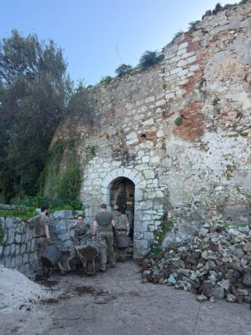
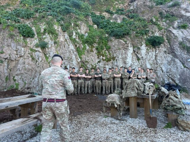
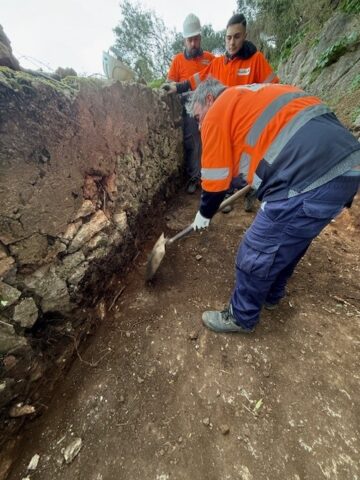
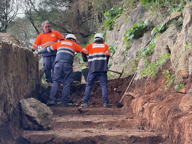
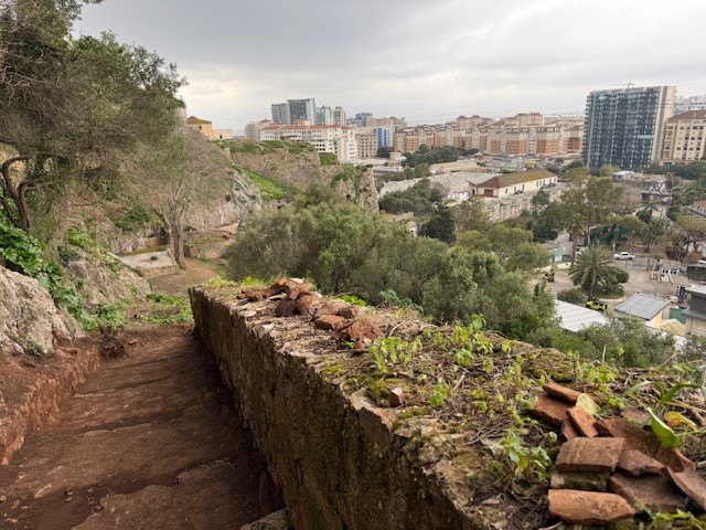
On Friday February 20, personnel from the Royal Engineers carried out a vegetation clearance and familiarisation exercise within the King’s Lines Place of Arms, a key space within the defensive network guarding Gibraltar’s northern approaches.
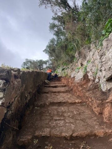
The work formed part of a wider effort to improve access and visibility in areas that had been obscured by decades of plant growth. It has also revealed previously undocumented structural and pathway elements associated with the defensive system. These discoveries are now subject to ongoing archaeological assessment and historical review by experts as part of the Northern Defences programme.
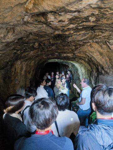
The following Monday, the site hosted visiting university students from Japan. The group was guided through key sections of the defensive network and briefed on the conservation and enhancement works currently under way.
During the visit, Project Director for the Northern Defences Carl Viagas outlined both the ongoing works and the broader significance of Gibraltar’s layered built heritage, from Spanish and Moorish phases through to the extensive British-era military engineering.
Mr Viagas said: “The Northern Defences are more than just historic structures, they represent a unique opportunity to connect our community with Gibraltar’s past while creating meaningful educational and economic benefits for the future.”
“Through initiatives such as these visits, we are able to bring students, volunteers and professionals into direct contact with our shared heritage, helping to foster a sense of ownership and appreciation while also supporting the development of sustainable heritage tourism.”
Engagement with stakeholders continued on Friday February 27, when Fortress Attractions Ltd and the Gibraltar Heritage Trust jointly organised a site visit. This brought together people with an interest in conservation of history and heritage on the Rock and offered a chance to review progress on the ground and discuss future phases of interpretation and public access.
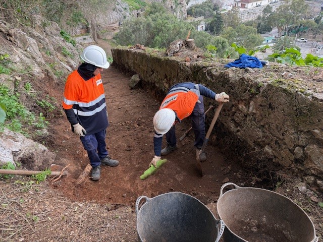
Alongside these visits, archaeological work continues across the site.
Mr Viagas noted that recent investigations have exposed a historic communication route linking the Puerta de Granada sector with what could be a structure intended as an advanced observation point overlooking the northern isthmus and likely attributable to the Arab period.
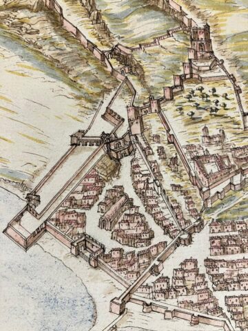
“The alignment, absent from many historical plans including those of Bravo (1627), appears to form part of a previously unrecorded internal movement network within the defensive complex,” he said.
“Excavation in this area is ongoing under archaeological supervision, with early findings already pointing to the presence of constructed stone surfacing and stepped access, potentially indicative of a formalised ramped pathway facilitating communication between rear defensive positions and forward lookout points.”
As works continue, Mr Viagas pledged that the Northern Defences project remains committed, not only to the conservation of Gibraltar’s historic fortifications, but also to ensuring that these spaces are re-integrated into the civic and educational life of the community, “bridging the gap between past and present through responsible stewardship and public engagement.”
Alongside the physical archaeological works, historical research is under way drawing on historic texts, cartographic material and archival documents relating to Gibraltar’s pre-British periods.
“These sources, including early Spanish military accounts, administrative descriptions, and previously under-referenced plans such as those of Luis Bravo (1627), are providing valuable insight into the form and function of defensive infrastructure established during the Spanish and earlier Islamic occupations of the Rock,” said Mr Viagas.
“In several instances, documentary evidence has offered explanatory context for structural features now being revealed on site, helping to situate newly exposed paths, walls, and communication routes within a broader defensive landscape that predates the well-documented British interventions of the 18th and 19th centuries.”
He added that the integrated approach, which combines LiDAR technology, architectural investigation, archaeological excavation and archival research, is allowing for a more nuanced understanding of Gibraltar’s layered military heritage rather than viewing the Northern Defences solely through the prism of later British engineering, the project increasingly able to trace elements of continuity in spatial organisation and defensive logic extending back into earlier phases of occupation.
Importantly, he added that this work is not confined to academic or professional circles alone and that interest in the Rock’s earlier history has grown within the local community, with heritage groups, volunteers, students, and independent researchers becoming actively engaged in both site visits and discussions surrounding the interpretation of newly uncovered features.
“Public outreach initiatives, including guided tours and collaborative visits organised in partnership with local institutions, are helping to bridge the gap between specialist research and wider civic awareness,” said Mr Viagas.
“As understanding of these pre-British phases develops, the Northern Defences project continues to foster a sense of shared custodianship over Gibraltar’s historic environment, ensuring that both the material remains and the documentary record of the Rock’s past are brought into the public domain as part of a living and accessible heritage.”
Most Read
Leading human evolution researchers to meet in Gibraltar for Calpe ’26 Conference
Tue 2nd Jun, 2026
UK to ban social media for under 16s, in move welcomed by Gib campaigners
Mon 15th Jun, 2026

Today's Paper
11th March 2026
Read our latest newspaper by downloading our app from the link below.

